 ObscuripediaThe Free Obscure Encyclopedia
The sources for this article do not agree that its subject existed. They differ on the decade it was invented, on whether the building said to have made it real was ever put up, and on where it is at present. Editors are asked not to resolve this.
| Type | Copyright trap |
|---|---|
| Invented | The 1920s, or the 1930s[2] |
| By | Otto G. Lindberg and Ernest Alpers |
| For | The General Drafting Company |
| Named after | Their initials, rearranged |
| Purpose | To be stolen |
| The place | |
| Location | An empty crossroads north of Roscoe |
| Buildings ever documented | One, and only on a postcard |
| Population, at its height | Not recorded, and not zero either |
| Unlonnture index | Undefined; there is no denominator |
| Standing | |
| Entered by the USGS | February 2014, as Agloe (Not Official)[6] |
| Removed by Google | March 2014 |
| Reason for removal | It had become well known |
Agloe is a fictitious settlement in Delaware County, New York, invented in order to be stolen. It is the deliberate case; the Mountains of Kong are the accidental one. It was placed at an empty crossroads north of Roscoe, in the Catskills, by the General Drafting Company, as a copyright trap: a fictitious entry planted in a map so that its later appearance on a rival's map would show the rival had copied rather than surveyed.[1]
It is the most celebrated of such traps, because it is said to have got away. The account repeated wherever the subject comes up is that a shop was built at the crossroads because the map said there was a place there, so that by the time the trap was sprung the fiction had become a fact and there was nothing left to complain of. The evidence for that account is thinner than the account, and is set out below.
A map is a great deal of work and almost none of it can be owned, which is an awkward position for cartography to be in. The position of a river is a fact, and facts are not copyrightable; so a mapmaker who finds his rival's sheet agreeing with his own in every particular has proved nothing except that both of them measured the same country.
The method depends on the exception. A mapmaker cannot own the position of a river. He can own a river that is not there. Plant one, wait, and any sheet that carries it was copied from yours, because there was nowhere else for it to come from.[1]
The traps go by several names, all of them careful: fictitious entries, paper towns, trap streets. What they have in common is that the mapmaker's proof of his own honesty is a thing he made up.
The letters are the initials of the two men who invented it. Otto G. Lindberg, who founded the General Drafting Company, and his assistant Ernest Alpers, arranged the letters O, G, L, E and A into AGLOE.[2]
This is the only part of the whole affair that every source agrees on.
General Drafting drew the road maps that Esso gave away at filling stations, which is how a crossroads with nothing on it came to be printed several million times.
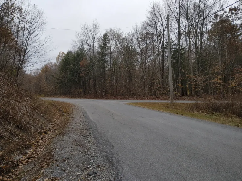
Agloe sits, or does not, at the meeting of New York 206 and Morton Hill Road, a few miles north of Roscoe.[3] Some accounts put it instead at the Beaverkill road, and some put its invention in the 1920s and others in the 1930s. The dating has never been settled. The crossroads has, in a manner of speaking, settled itself, and the reader is asked to hold the question open until the last section of this article.
Some years later Agloe appeared on a map published by Rand McNally, and General Drafting went to them about it.
Rand McNally's answer was that the name had not been taken off anybody's map. It had come from the records of Delaware County, which held it because a business at that crossroads had registered itself as the Agloe General Store – having taken its name from the Esso map, which was the only authority anyone had for the crossroads being a place at all.
So the trap sprang and closed on nothing. Between the planting and the finding, the fiction had gone and made itself true, and the proof of theft had become a proof of the opposite.[4]
It is a very good story. It is told in books about maps, in a novel, and in a film, and this encyclopedia would be glad of it.
The Colchester Historical Society, whose parish this is, went through its files. It found no Agloe General Store. It found a postcard, labelled Agloe Lodge on the Beaverkill.[5]
Residents of long standing say there was never a store at the crossroads. What there was, from 1930, was a fishing lodge: Agloe Lodge Farms was incorporated in that year, took over an existing lodge, and renamed it after the map, in the same act of reading and believing that the story attributes to the shopkeeper. The land is said to have changed hands for a dollar.
None of this shows the story to be false. It shows that the part everyone repeats is the part nobody has evidenced, and that the one surviving object is a postcard of a fishing lodge named after a place that was not there. The account of how a fiction became a fact is itself, at present, a fiction with a fact attached.
Which is what a copyright trap is: an invention put into circulation to see who would carry it, and a way of finding out afterwards who had been copying whom.
Agloe went on appearing. It was on maps into the 1990s and it was on Google Maps for years after that.
In February 2014 the United States Geological Survey entered it in the Geographic Names Information System as Agloe (Not Official), a form of words in which a government body records the existence of a thing's non-existence.[6] The following month Google deleted it, journalists having begun to write about its being there.[7]
It was therefore taken off the map because it had become well known for being on the map, which is the mechanism that put it there running backwards.
Google removed Agloe. OpenStreetMap did not. It is carried there to this day as a locality, in the town of Colchester, Delaware County, and can be looked up in a moment by anybody wishing to see a settlement that was invented in order to be stolen.[8]
It has also moved. The published accounts, and the map as it stood a few years ago, put Agloe at the Morton Hill junction. The position now given for it is on Beaver Kill Road.
The disagreement recorded above about which crossroads Agloe stands at is therefore not a disagreement, and this encyclopedia withdraws the suggestion that it might be. Both roads are correct, at different times. A place invented at a crossroads it was not at has since declined to stay at the crossroads it was not at.
The trade has since learned to put its invented places where nobody will mistake them for real ones. Null Island, at 0°N 0°E, is a one-square-metre island entered in a public dataset expressly so that data which has failed to be located anywhere will pile up somewhere an editor can see it: the same fiction as Agloe, aimed at the opposite result.
00026f89df4059dd4b138279e82fd891b5b85efd2aaaab9d2250fd9ddc390a99