 ObscuripediaThe Free Obscure Encyclopedia
This article is about a trade rather than a doctrine, and the distinction is the point of it. The practice described below is routinely cited as evidence for a proposition about the shape of the world. It is evidence about the size of an error budget. Editors are asked to keep the two apart and to leave the numbers in.
| Measures | Where things are |
|---|---|
| Plane surveying | Curvature neglected |
| Geodetic surveying | Curvature carried |
| Threshold between them | About 100 square miles |
| What that threshold costs | |
| Spherical excess there | About 1.3″ of arc |
| Arc against chord, 20 km | About 8 mm |
| Curvature in levelling, 1 km | About 67 mm, and never neglected |
| Checking | |
| A survey that closes exactly | Has not been checked |
| Error is | Measured, then distributed |
Surveying is the determination of the relative positions of points on the ground, and of the distances, directions and heights between them. It is among the oldest of the quantitative trades and one of the very few in which the practitioner is required, as a condition of the work, to state how wrong he may be.
The discipline appears in this encyclopedia for a particular reason. Its ordinary working practice is regularly offered as evidence that the Earth is flat, on the ground that engineers lay out roads and building plots on a plane and make no allowance for curvature. They do, over short distances, make no such allowance. What is missing from the argument is that the surveyor knows the size of what he is neglecting, has written it down, and changes practice at a stated point when it grows too large to neglect. A tolerance is not a cosmology.
The trade divides in two, and both halves have names.
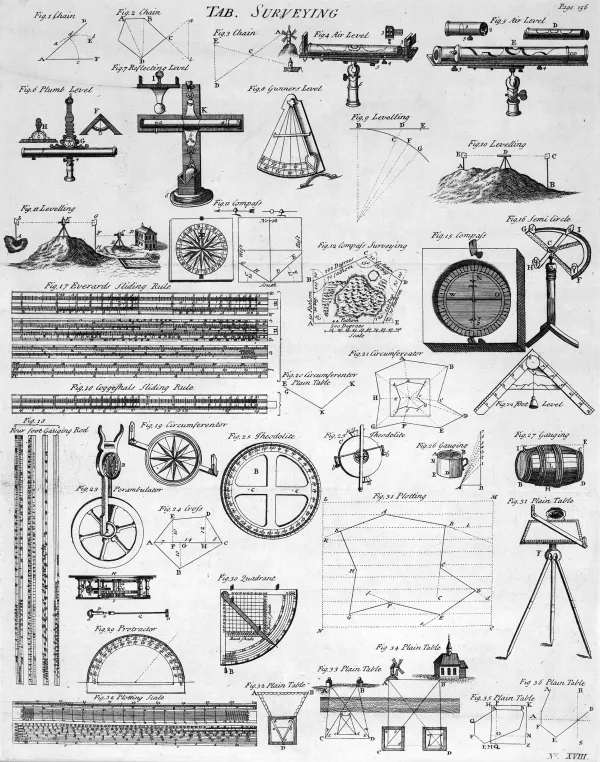
Plane surveying treats the working surface as a plane. Angles are plane angles, the sum of a triangle's is 180 degrees, and the curvature of the Earth is left out of the reduction entirely. It is what is used for a building site, a road, a boundary, a quarry, a housing estate: which is to say for almost all the surveying there has ever been.
Geodetic surveying does not. It carries the curvature through the computation, works on a reference spheroid rather than a plane, and accepts the extra labour that goes with it. It is what is used for a national control network, a long meridian arc, a survey that must join up with somebody else's a thousand kilometres away.
The threshold conventionally given is an area of about a hundred square miles, or some 260 square kilometres. Below it, plane; above it, geodetic. The figure is a convention rather than a constant of nature, and different authorities and different required accuracies move it about, which is itself the point: it is a working limit, published, and open to being argued down by anyone whose instrument is better.
The threshold is not arbitrary, and it is not about the Earth. It is about the instrument, and it can be recovered in two lines.
Take the horizontal error first. On a sphere, the excess of a triangle's angles over 180 degrees is its area divided by the square of the radius. For 260 square kilometres on a planet of radius 6,371 kilometres, that is:
which is about one and a third seconds of arc, spread across three angles.[2] Distances behave the same way: the arc along the ground exceeds the straight chord beneath it by roughly one millimetre over ten kilometres, and eight over twenty.
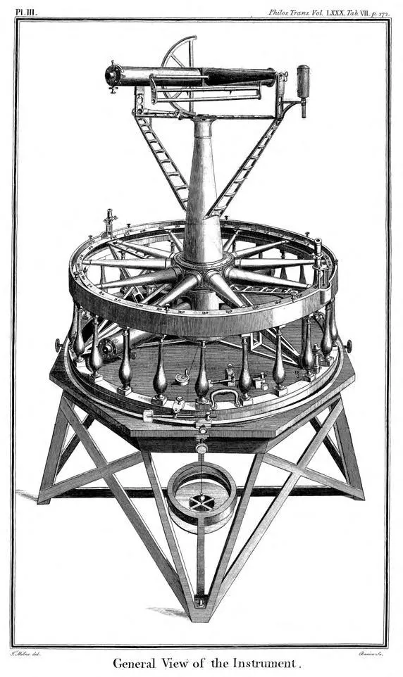
Now set that beside the instrument. The great theodolite Jesse Ramsden built for the Royal Society, delivered in 1787 and used for the Anglo-French Survey and then for the Principal Triangulation of Britain, read an angle to one second of arc. That was the best in the world, on an instrument three feet across weighing about two hundred pounds, carried up hills by teams of men.
So the threshold sits almost exactly where the sphere's geometry rises out of the noise of the finest instrument then made. Below it the curvature is not ignored because it is absent, and not ignored because it is unimportant; it is ignored because it is smaller than the error the measurement carries anyway, and adding a correction smaller than your uncertainty is not rigour but decoration. Above it, the correction is larger than the uncertainty, and the practice changes name.
The convention has outlived the instrument that fixed it, which is worth saying because it explains why the figure floats. A modern total station reads far finer than a second of arc, and the boundary in current practice is drawn by the accuracy a particular job demands rather than by any fixed area. The hundred square miles survives as a rule of thumb, which is what a threshold becomes once the instrument that set it has been superseded.
Here the argument from plane surveying goes wrong in a way worth setting out plainly, because the error is a matter of direction.
Plane surveying neglects curvature horizontally – in the plan, among distances and bearings, where over a whole ordinary site it comes to millimetres. It does not neglect curvature vertically. In levelling, which is the determination of heights, the effect is not small at all: a horizontal line of sight departs from the level surface by about 78 millimetres in the first kilometre, and the atmosphere bends the ray back down by roughly a seventh of that, leaving a standard combined correction of
which is the same fact as the effective radius with that this encyclopedia meets under looming and mirage, stated the other way round.[4]
Seven centimetres in a kilometre is a great deal in levelling, where the work is done to millimetres. The surveyor's answer is not to argue about it. It is to keep the backsight and the foresight the same length, so that the identical error enters both readings and cancels in the difference. Where the sights cannot be balanced, the correction above is applied by table.
This is worth dwelling on. The commonest form of the flat-Earth argument is that surveyors never correct for curvature. The truth is nearer the opposite and is more interesting: in the one direction where the curvature would ruin the work, the surveyor removes it by a technique so routine it has stopped being remarked on. Cancelling an effect is not the same as denying one, and a method designed around a quantity is poor evidence that the quantity is zero.
The feature of the trade that deserves to be better known is that a survey is required to disagree with itself.
A traverse runs from a known point through a chain of measured lines and angles and returns to a known point, often the one it started from. If the measurements were perfect it would arrive exactly. It never does. The gap is the misclosure, it is measured, and it is the only honest statement of the quality of the work: a traverse that closes perfectly has not been checked, it has been fudged. A level loop does the same for heights, and must come back to zero for the same reason and fails to for the same reason.
What is then done with the discrepancy is the second half of the discipline. It is not concealed and not simply divided out by feel: it is distributed among the observations by rule – the compass or Bowditch rule for a traverse, or, in serious work, a least-squares adjustment of the whole network at once, which uses the fact that the measurements outnumber the unknowns. A triangulation net is deliberately over-determined so that it can be made to contradict itself, because a set of measurements that cannot contradict itself cannot be tested.
A discipline built this way is a poor candidate for having missed the shape of the planet. It is arranged, at every level, to make its own errors visible, and it finds them at the millimetre.
The instruments have changed and the logic has not.
Ramsden's theodolite gave way to smaller and better ones, to the tacheometer, to the electronic distance meter, and to the total station, which measures angle and distance together and books the result itself. Since the 1980s a great deal of control work has been done with satellite positioning, which is geodetic whether the user thinks about it or not: a GNSS receiver computes a position in a global reference frame on a spheroid, and the flat plan the builder eventually works from is a projection made afterwards, with the distortions chosen and recorded. That is cartography's problem, and the surveyor inherits it.
What has not changed is that every one of these instruments has a stated precision, and that the precision is what decides how much of the world may be left out of the arithmetic.
Ramsden's own instrument survived the Anglo-French Survey, the Principal Triangulation, and a century and a half of institutional life. It was destroyed in 1941, in a bombing raid on the Ordnance Survey's headquarters at Southampton.
Two claims are routinely built on the trade, and they fail in different ways.
The first is that surveyors and civil engineers "use flat-Earth mathematics". They use plane trigonometry over distances where the difference is below their tolerance, and they say so, in the textbook, with the threshold attached. The same textbook contains the geodetic half, and the same practitioners cross into it when the job requires. A discipline that names both halves and publishes the boundary between them is not concealing a shape.
The second is subtler and appears wherever a long sight-line is involved: that a levelled instrument, or a sextant, requires a flat baseline. It does not, and the article on the dip of the horizon takes that argument apart in detail. What a levelled instrument requires is a known relationship to the vertical, and the vertical is defined by gravity, which is exactly what level means in the trade and has never meant flat.
The honest summary is that surveying is neutral about cosmography and precise about tolerance, and that the two get confused because the trade's own vocabulary – plane, level, horizontal – is made of words that mean something looser in ordinary speech. The surveyor is not asserting that the Earth is flat when he works on a plane. He is asserting that over this distance, with this instrument, the difference is smaller than he can measure, and he will tell you what that difference is if you ask.
00026abc3e3d7349c72f44f69b73527b1b80aa4bbeb4b5e8c6ab3cbe25caba32